Anytime this winter that I’ve mentioned a good pattern showing up in the medium range, it’s fizzled to nothing, so it’s pretty exciting to see this afternoon’s Euro model run hold the course for the possibility of snow for Saturday. The GFS is still weak sauce to the south, and the NAM doesn’t even know there’s a storm brewing, but having the Euro on our side within 3 days is the hand that I think we want to be holding at this point. Obviously, there are still an endless number of ways we can get shafted, but right now I like our chances at a 2 – 4″ snowfall in central MD.
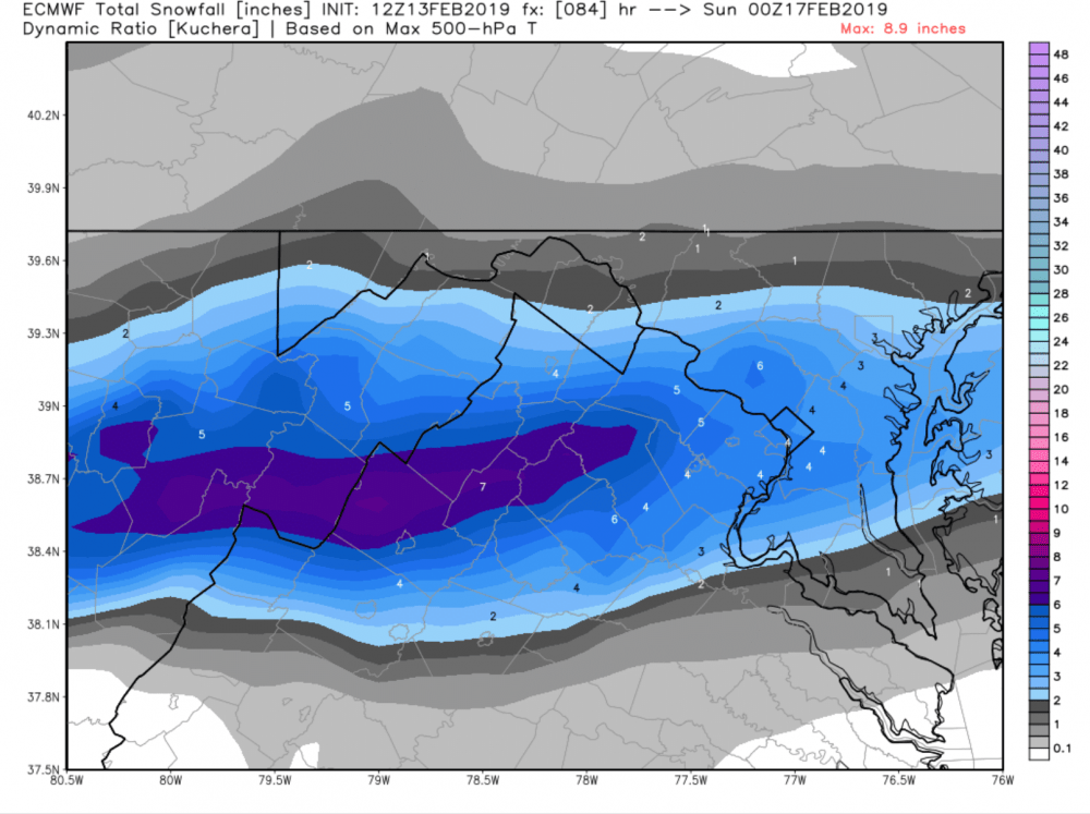
Verbatim, the Euro has the most snow just to our southwest, but there are going to be changes before the weekend, so no point in getting caught up in specifics. The biggest worry is that the coverage area of snow is pretty narrow, so if the snow materializes, not all of us would be getting in the jackpot. Here’s a visual of the current Euro snow map to see what I’m talking about, but use it with caution. Snow maps are pretty, but rarely accurate from this range.
Between now and Saturday, there is going to be some pretty nice weather, so enjoy it while you can. Beyond Saturday, the pattern looks slightly colder than normal and very active.
